Electronics > Marine Electronics > Fish FindersHumminbirdSold by Humminbird Johnson Outdoors

Humminbird

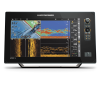
APEX 16 MEGA SI+ CHARTPLOTTER Fish Finder, 15.6"

Our editorial team reviews specifications, product data, and field-use information to keep pages accurate.

15.6" Full-hd

Touchscreen display for customized chartplotter

Mega Imaging+

Dual Spectrum CHIRP sonar included

Advanced Networking

NMEA 2000, HDMI In/Out, WiFi,

Includes Lakemaster

CoastMaster VX Maps for U.S

1-foot Contours

Plus depth and shallow water

$4199.99
View on Humminbird Johnson Outdoors

You'll be taken to Humminbird Johnson Outdoors to complete your purchase.

Hunter's Outpost earns a commission from affiliate links at no extra cost to you.

SKU: 1125268

Overview

Built for anglers who want a large, information-rich display at the helm, this 15.6-inch Full-HD touchscreen combines chartplotting and sonar in one network-ready unit. It includes LakeMaster and CoastMaster VX Maps for coverage across more than 13,000 lakes, waterways, and coastal waters in the United States and Canada, along with 1-foot contours and depth and shallow-water highlights to support route planning. MEGA Imaging+ and Dual Spectrum CHIRP sonar come standard, and the dedicated sonar channel adds flexibility for compatible accessory 2D CHIRP transducers up to 2kW. With NMEA 2000, HDMI In/Out, WiFi, Bluetooth, and One-Boat Network integration, it suits serious boat setups that need broad connectivity and a customizable screen layout.

Why Hunters Choose the Humminbird

15.6-inch Full-hd

Touchscreen offers a large, customizable

Includes Lakemaster

CoastMaster VX Maps for U.S

1-foot Contours

Plus depth and shallow-water highlights

Mega Imaging+

Dual Spectrum CHIRP sonar come

Advanced Connectivity

Includes NMEA 2000, HDMI In/Out,

Key Features

  • 15.6" Full-HD touchscreen display for customized chartplotter and sonar views
  • MEGA Imaging+ and Dual Spectrum CHIRP sonar included
  • Advanced networking with NMEA 2000, HDMI In/Out, WiFi, and Bluetooth
  • Includes LakeMaster and CoastMaster VX Maps for U.S. and Canada waters
  • 1-foot contours plus depth and shallow water highlights support navigation
  • Dedicated sonar channel supports accessory 2D CHIRP transducers up to 2kW

Best Used For

  • Anglers wanting a large touchscreen chartplotter for detailed sonar and navigation information
  • Boaters using networked electronics with NMEA 2000, HDMI, WiFi, or Bluetooth integration
  • Users fishing mapped lakes, waterways, and coastal areas in the United States and Canada
  • Those needing included LakeMaster and CoastMaster VX Maps for route planning and spot finding
  • Serious anglers building a One-Boat Network with compatible Humminbird, Minn Kota, or Cannon gear

Specifications

Accessory Transducer SupportDedicated sonar channel for accessory 2D CHIRP transducers up to 2kW
Boat Control IntegrationMinn Kota
Contour Detail1-foot contours
Coverage AreaOver 13,000 lakes, waterways, and coastal waters in the United States and Canada
Display Size15.6"
Display TypeFull-HD touchscreen
Downrigger ControlWireless Cannon Optimum downrigger control
Gps Charts IntegrationHumminbird GPS charts
Included MapsLakeMaster VX Maps, CoastMaster VX Maps
Network OptionsNMEA 2000, HDMI In/Out, WiFi, Bluetooth
One Boat NetworkYes
SonarMEGA Imaging+ and Dual Spectrum CHIRP sonar
Water HighlightsDepth highlights, Shallow water highlights

Pros

  • 15.6-inch Full-HD touchscreen offers a large, customizable display for navigation and sonar views.
  • Includes LakeMaster and CoastMaster VX Maps for U.S. and Canada waters.
  • 1-foot contours plus depth and shallow-water highlights support route planning.
  • MEGA Imaging+ and Dual Spectrum CHIRP sonar come standard.
  • Advanced connectivity includes NMEA 2000, HDMI In/Out, WiFi, and Bluetooth.
  • Dedicated sonar channel supports accessory 2D CHIRP transducers up to 2kW.

Considerations & Trade-offs

  • The 15.6" Full-HD touchscreen offers a large, information-rich layout, which may be more than needed for anglers who prefer a simpler display or a smaller helm footprint.
  • Included LakeMaster and CoastMaster VX Maps cover over 13,000 lakes, waterways, and coastal waters in the U.S. and Canada, but map usefulness will still depend on the waters you fish and whether that coverage matches your area.
  • Advanced networking features such as NMEA 2000, HDMI In/Out, WiFi, Bluetooth, and One-Boat Network integration add flexibility, but they also make setup and system planning more involved than a basic standalone unit.
  • The unit includes MEGA Imaging+ and Dual Spectrum CHIRP sonar, with a dedicated channel for accessory 2D CHIRP transducers up to 2kW, so getting the most from it may require additional compatible accessories beyond the chartplotter itself.

Suggested Comparisons

  • Large-format chartplotter and fish finder
  • Standalone sonar unit with mapping
  • Multi-function marine display

Suggested Accessories

  • Chartplotter mounting bracket
  • NMEA 2000 network cable
  • HDMI cable
  • Transducer accessory

Frequently Asked Questions

What screen size does the APEX 16 MEGA SI+ Chartplotter have?

It features a 15.6" Full-HD touchscreen display.

What mapping comes included with this chartplotter?

It includes LakeMaster and CoastMaster VX Maps, with coverage for over 13,000 lakes, waterways, and coastal waters in the United States and Canada.

What sonar technologies are included?

The unit comes standard with MEGA Imaging+ and Dual Spectrum CHIRP sonar.

What connectivity and networking options does it support?

The product description lists NMEA 2000, HDMI In/Out, WiFi, and Bluetooth as supported network and connectivity options.

Can it work with other boat systems?

Yes. The description says it can integrate through the One-Boat Network with Humminbird GPS charts, Minn Kota boat control, and wireless Cannon Optimum downrigger control.