Software > Computer Software > Gps Map Data & SoftwareHumminbirdSold by Humminbird Johnson Outdoors

Humminbird

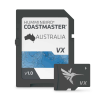
CoastMaster, Australia Map

Our editorial team reviews specifications, product data, and field-use information to keep pages accurate.

Highly Accurate

Chart coverage for Australian coastal

Easy-to-read Contours

Support route planning and navigation

Highlighted Depth

Ranges help identify likely fish-holding

Designed Help

You navigate with confidence

Humminbird Coastmaster

Map for Australia

$199.99
View on Humminbird Johnson Outdoors

You'll be taken to Humminbird Johnson Outdoors to complete your purchase.

Hunter's Outpost earns a commission from affiliate links at no extra cost to you.

SKU: 1115209

Overview

Humminbird CoastMaster for Australia is built for anglers who want detailed chart coverage of Australian coastal waters when planning time on the water. Its easy-to-read contours and highlighted depth ranges help you study structure and identify areas that may hold fish before you get there. The chart is designed to support confident navigation while you move between spots. It is a practical choice for serious fishing trips where route planning and location detail matter.

Why Hunters Choose the Humminbird

Highly Detailed

Chart coverage for Australian coastal

Easy-to-read Contours

Support clearer route and area

Highlighted Depth

Ranges help identify likely fish-holding

Designed Support

Confident navigation along the coast

Useful Anglers

Planning trips around Australian waters

Key Features

  • Highly accurate chart coverage for Australian coastal waters
  • Easy-to-read contours support route planning and navigation
  • Highlighted depth ranges help identify likely fish-holding areas
  • Designed to help you navigate with confidence
  • Humminbird CoastMaster map for Australia

Best Used For

  • Australian coastal anglers needing detailed chart coverage for route planning and fishing spot selection
  • Boaters who want easy-to-read contours and highlighted depth ranges for navigation support
  • Serious fishers targeting known holding areas in coastal waters and nearby structure
  • Humminbird users looking for Australia-specific mapping for confident on-water decision-making

Specifications

AccuracyHighly accurate
Chart CoverageAustralian coastal waters
ContoursEasy-to-read contours
Depth RangesHighlighted depth ranges
DetailIncredible accuracy and detail
Navigation SupportNavigate there with confidence

Pros

  • Highly detailed chart coverage for Australian coastal waters
  • Easy-to-read contours support clearer route and area interpretation
  • Highlighted depth ranges help identify likely fish-holding spots
  • Designed to support confident navigation along the coast
  • Useful for anglers planning trips around Australian waters

Considerations & Trade-offs

  • Coverage is specific to Australian coastal waters, so it is not a universal chart solution for other regions.
  • The product focuses on chart detail and navigation support; it does not replace local knowledge, weather awareness, or safe boating practices.
  • Its value depends on having compatible Humminbird charting equipment and using the map in the intended marine environment.
  • The price point is relatively high, so it is best suited to anglers who will make regular use of detailed coastal chart coverage.

Suggested Comparisons

  • Coastal marine chart card
  • Inland lake and river mapping card
  • Fishing electronics accessory

Suggested Accessories

  • Marine chart card holder
  • Chartplotter mounting bracket
  • Protective storage case
  • Screen cleaning cloth

Frequently Asked Questions

What area does CoastMaster, Australia cover?

It provides highly accurate chart coverage for Australian coastal waters.

What information is shown on the map?

The description mentions easy-to-read contours and highlighted depth ranges.

Is this intended for finding fishing spots or just navigation?

The product is described as helping you identify spots that are likely to hold fish and navigate there with confidence.

Does the product description specify compatible devices or formats?

No. The provided data does not include compatibility, file format, or device details.

Are the exact map scale, depth intervals, or coverage limits listed?

No. Those specifics are not provided in the source data.