Software > Computer Software > Gps Map Data & SoftwareHumminbirdSold by Humminbird Johnson Outdoors

Humminbird

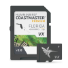
CoastMaster Premium Florida V2 with Bahamas Map

Our editorial team reviews specifications, product data, and field-use information to keep pages accurate.

Highly Accurate

Chart coverage for all Florida

Includes Boat

Lanes for Florida waters

Includes Contours

For the Bahamas

Easy-to-read Contours

For navigation

Highlights Depth

Ranges to help identify fish-holding

$599.99
View on Humminbird Johnson Outdoors

You'll be taken to Humminbird Johnson Outdoors to complete your purchase.

Hunter's Outpost earns a commission from affiliate links at no extra cost to you.

SKU: 1118352

Overview

Built for anglers running Florida waters and nearby Bahamas routes, this chart package combines detailed coverage with practical navigation support. It includes boat lanes for Florida and contour information for the Bahamas, along with easy-to-read contours and highlighted depth ranges to help you plan where to go and how to get there. The focus is on giving you the information needed to locate likely fishing areas while moving with greater confidence.

Why Hunters Choose the Humminbird

Highly Accurate

Chart coverage for all Florida

Includes Boat

Lanes for Florida waters

Adds Contour

Coverage for the Bahamas

Easy-to-read Contours

Support quick interpretation

Highlighted Depth

Ranges help identify likely fish-holding

Key Features

  • Provides highly accurate chart coverage for all Florida waters.
  • Includes boat lanes for Florida waters.
  • Includes contours for the Bahamas.
  • Features easy-to-read contours for navigation.
  • Highlights depth ranges to help identify fish-holding spots.
  • Designed to help you navigate safely to your destination.

Best Used For

  • Anglers running Florida waters who want detailed chart coverage and depth-range reference points
  • Boaters navigating Florida boat lanes and looking for clearer route planning on the water
  • Users fishing the Bahamas who need contour information for navigation and spot selection
  • Serious hunters and anglers who prefer map detail that supports safer travel to known locations

Specifications

Boat LanesFlorida
Chart CoverageFlorida waters
ContoursBahamas
Fish Finding ToolsIncluded
Highlighted Depth RangesIncluded
Navigation SupportIncluded

Pros

  • Highly accurate chart coverage for all Florida waters
  • Includes boat lanes for Florida waters
  • Adds contour coverage for the Bahamas
  • Easy-to-read contours support quick interpretation
  • Highlighted depth ranges help identify likely fish-holding areas
  • Supports safer navigation to planned spots

Considerations & Trade-offs

  • Coverage is focused on Florida waters, with Bahamas contours included, so it may not suit anglers who need broader multi-region chart coverage.
  • The product emphasizes chart detail and highlighted depth ranges, which is useful for planning but still requires the user to interpret the data for their specific fishing conditions.
  • Boat lanes are included for Florida, but that added navigation detail is region-specific rather than a universal mapping feature.
  • At $599.99, this is a specialized charting product, so it makes the most sense for anglers who regularly fish the covered areas.

Suggested Comparisons

  • Marine navigation charts for other regions
  • Fishing GPS mapping cards
  • Depth contour map products
  • Boat lane navigation guides

Suggested Accessories

  • Chartplotter mount
  • Protective screen cover
  • Marine power cable
  • GPS antenna

Frequently Asked Questions

What waters does CoastMaster Premium Florida V2 with Bahamas cover?

It provides chart coverage for all Florida waters and includes boat lanes for Florida plus contours for the Bahamas.

What kind of information does this map provide for navigation and fishing?

The product description says it includes easy-to-read contours and highlighted depth ranges, along with boat lanes for Florida.

Is this product intended only for Florida, or does it include the Bahamas as well?

It includes both: chart coverage for all Florida waters and contours for the Bahamas.

Does the description say how detailed or accurate the charts are?

Yes. The product is described as providing highly accurate chart coverage, but no additional technical detail is given.

Can I use this to help identify likely fishing spots?

According to the description, the contours and highlighted depth ranges are meant to help you identify spots that will hold fish and navigate there safely.