Image unavailable
Our editorial team reviews specifications, product data, and field-use information to keep pages accurate.
You'll be taken to Humminbird Johnson Outdoors to complete your purchase.
Hunter's Outpost earns a commission from affiliate links at no extra cost to you.
SKU: 1108698
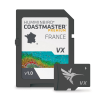
Built for anglers working French coastal waters, this chart package is intended to support route planning and on-the-water navigation with detailed coverage. It presents contours and highlighted depth ranges in a format designed to help you evaluate likely fishing areas before you commit to a spot. For serious trips where local water detail matters, it offers a focused mapping reference rather than a general-purpose chart.
Highly Accurate
Chart coverage for French coastal
Includes Easy-to-read
Contours for clearer route and
Highlighted Depth
Ranges help identify likely fish-holding
Designed Support
Confident navigation along coastal waters
Focused Coverage
For anglers targeting French coastal
| Accuracy | Highly accurate |
|---|---|
| Chart Coverage | French coastal waters |
| Contours | Highlighted |
| Depth Ranges | Highlighted |
| Detail | Incredible accuracy and detail |
| Fishing Use | Identify spots you know will hold fish |
| Navigation Support | Navigate there with confidence |
It provides chart coverage for French coastal waters.
The product description says it includes easy-to-read contours and highlighted depth ranges.
Yes. The description says it is designed to help you identify likely fishing spots and navigate there with confidence.
No. Compatibility details are not provided in the source data.
No technical specifications are provided beyond the product title and the description of chart coverage, contours, and highlighted depth ranges.