Image unavailable
Our editorial team reviews specifications, product data, and field-use information to keep pages accurate.
You'll be taken to Fin Feather Fur Outfitters to complete your purchase.
Hunter's Outpost earns a commission from affiliate links at no extra cost to you.
SKU: 010-13226-MC-753759306694
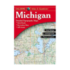
This Michigan atlas and gazetteer is built for planning time in the field, with detailed paper maps that help you organize travel, recreation, and route options across the state. It includes topographic mapping with elevation contours, major highways and roads, dirt roads, trails, and land use data, giving hunters and other outdoor users a broader view of access and terrain. The gazetteer section adds practical reference points such as campgrounds, fishing spots, boat launches, hunting zones, parks, scenic drives, and other places of interest. It is a useful companion for back-road travel, sightseeing, and trip planning when a paper map is the preferred tool.
Includes Michigan
Recreation locations such as campgrounds,
Topographic Maps
Major highways, roads, dirt roads,
Gazetteer Section
Lists points of interest, landmarks,
Useful Sightseeing,
Back-road exploring, outdoor recreation, and
Large-format Paper
Atlas presents detailed mapping in
| Boat Launches | included |
|---|---|
| Campgrounds | included |
| Canoe Trips | included |
| Dirt Roads | included |
| Elevation Contours | included |
| Fishing Spots | included |
| Format | large-format paper maps |
| Gazetteer Section | included |
| Golf Courses | included |
| Historic Sites | included |
| Hunting Zones | included |
| Land Use Data | included |
| Landmarks | included |
| Major Highways And Roads | included |
| Map Type | topographic maps |
| Points Of Interest | included |
| Recreation Sites | included |
| Scenic Drive Recommendations | included |
| State | Michigan |
| State And National Parks | included |
| Trails | included |
| Trip Planning | included |
The source data says it includes topographic maps with elevation contours, major highways and roads, dirt roads, trails, and land use data. The gazetteer section also lists outdoor-relevant places such as campgrounds, fishing spots, boat launches, hunting zones, state and national parks, and more.
Yes. The product description says it is intended for sightseeing, exploring back roads, outdoor recreation, and trip planning. It also specifically mentions hunting zones, campgrounds, fishing spots, and general recreation sites in Michigan.
Yes. The listed map features include major highways and roads, dirt roads, and trails.
Yes. The gazetteer section is described as including points of interest, landmarks, state and national parks, campgrounds, boat launches, golf courses, historic sites, canoe trips, and scenic drive recommendations, though available information varies by state.
The source data describes it as large-format paper maps.