Camping GearDelormeSold by Fin Feather Fur Outfitters

Delorme

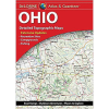
Delorme OHIO ATLAS & GAZETTEER

Our editorial team reviews specifications, product data, and field-use information to keep pages accurate.

Ohio Atlas

Gazetteer for recreation and trip

Large-format Paper

Topographic elevation contours

Includes Major

Highways, roads, dirt roads, trails,

Gazetteer Lists

Points of interest, landmarks, and

Includes Campgrounds,

Boat launches, hunting zones, and

$22.99
View on Fin Feather Fur Outfitters

You'll be taken to Fin Feather Fur Outfitters to complete your purchase.

Hunter's Outpost earns a commission from affiliate links at no extra cost to you.

SKU: 010-13226-HH-753759306663

Overview

This Ohio atlas and gazetteer is built for planning time in the field, whether the goal is scouting access, lining up a weekend trip, or finding recreation areas across the state. It combines detailed paper maps with topographic information, major highways and roads, dirt roads, trails, and land use data to help users orient themselves beyond the pavement. The gazetteer adds a practical reference layer with points of interest, landmarks, parks, campgrounds, boat launches, hunting zones, and other outdoor destinations. It is a straightforward tool for hunters and travelers who want a broad, map-based view of Ohio before heading out.

Why Hunters Choose the Delorme

Includes Ohio

Recreation locations such as campgrounds,

Topographic Maps

Show elevation contours, major highways,

Gazetteer Section

Organizes points of interest, landmarks,

Covers Campgrounds,

Boat launches, hunting zones, canoe

Useful Sightseeing,

Back road exploration, outdoor recreation,

Key Features

  • Ohio atlas and gazetteer for recreation and trip planning
  • Large-format paper maps with topographic elevation contours
  • Includes major highways, roads, dirt roads, trails, and land use data
  • Gazetteer lists points of interest, landmarks, and state and national parks
  • Includes campgrounds, boat launches, hunting zones, and canoe trips
  • Useful for sightseeing, exploring back roads, and outdoor recreation

Best Used For

  • Ohio trip planning for hunters and anglers needing campgrounds, fishing spots, and recreation sites
  • Back-road explorers who want topographic maps with roads, trails, and land use data
  • Outdoor users looking for gazetteer details on landmarks, parks, boat launches, and hunting zones
  • Sightseers and road-trippers planning scenic drives and general recreation stops across Ohio

Specifications

Boat LaunchesYes
CampgroundsYes
Canoe TripsYes
CoverageOhio
Dirt RoadsYes
Elevation ContoursYes
FormatLarge-format paper maps
Gazetteer SectionYes
Golf CoursesYes
Historic SitesYes
Hunting ZonesYes
Land Use DataYes
LandmarksYes
Major Highways And RoadsYes
Map TypeTopographic maps
Points Of InterestYes
Scenic Drive RecommendationsYes
State And National ParksYes
TrailsYes

Pros

  • Includes Ohio recreation locations such as campgrounds, fishing spots, and general outdoor sites.
  • Topographic maps show elevation contours, major highways, roads, dirt roads, trails, and land use data.
  • Gazetteer section organizes points of interest, landmarks, and state and national parks.
  • Covers campgrounds, boat launches, hunting zones, canoe trips, and scenic drive recommendations.
  • Useful for sightseeing, back road exploration, outdoor recreation, and trip planning.

Considerations & Trade-offs

  • State-specific details vary, so the depth of recreation and reference information may not be uniform across all sections of Ohio.
  • This is a large-format paper atlas, which is useful for planning and navigation but less convenient to carry than a compact guide.
  • The content is broad and map-focused, so it may not replace specialized local resources for highly specific hunting or access questions.
  • It is designed for exploration and trip planning, so users looking for only a narrow set of locations may find more information than they need.

Suggested Comparisons

  • State atlases and gazetteers
  • Topographic road maps
  • Outdoor recreation maps
  • Trip-planning maps

Suggested Accessories

  • State road atlas
  • Topographic map
  • Gazetteer guide
  • Trip planning notebook

Frequently Asked Questions

What kind of information does the Ohio Atlas & Gazetteer include for hunters and outdoor users?

It includes topographic maps with elevation contours, major highways and roads, dirt roads, trails, and land use data. The gazetteer section also lists outdoor-relevant points of interest such as landmarks, state and national parks, campgrounds, boat launches, historic sites, hunting zones, canoe trips, and scenic drive recommendations, with available information varying by state.

Is this atlas useful for planning trips beyond hunting?

Yes. The product description says it is intended for sightseeing, exploring back roads, outdoor recreation, and trip planning.

Does the Ohio Atlas & Gazetteer show recreation locations?

Yes. The description specifically mentions campgrounds, fishing spots, general recreation sites, and other outdoor points of interest.

Is this a paper map product or a digital map?

The product is described as large-format paper maps.

Does the product description specify exact map scale or page count?

No. The provided data does not include map scale or page count, so those details are unknown from the source information.