Image unavailable
Our editorial team reviews specifications, product data, and field-use information to keep pages accurate.
You'll be taken to Fin Feather Fur Outfitters to complete your purchase.
Hunter's Outpost earns a commission from affiliate links at no extra cost to you.
SKU: 010-13226-PA-753759339173
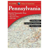
This atlas and gazetteer is built for navigating Pennsylvania beyond the main highways, with detail that includes back roads, dirt roads, trails, and elevation contours. It also highlights remote lakes and streams, boat ramps, public lands for recreation, land use and land cover, plus forests, wetlands, and agriculture. For hunters and anglers, the included trailheads, campgrounds, and prime hunting and fishing spots make it a practical planning tool for scouting and access decisions.
Includes Back
Roads, dirt roads, and trails
Shows Elevation
Contours to help assess terrain
Marks Remote
Lakes, streams, and boat ramps
Identifies Public
Lands, trailheads, and campgrounds for
Highlights Land
Use, forests, wetlands, and agriculture
| Atlas Name | Pennsylvania Atlas & Gazetteer |
|---|---|
| Detail Includes | Back roads, dirt roads and trails, elevation contours, remote lakes and streams, boat ramps, public lands for recreation, land use, land cover forests, wetlands, agriculture, trailheads, campgrounds, prime hunting and fishing spots |
| Specifications And Features | PENNSYLVANIA ATLAS & GAZETTEER |
The listed details commonly include back roads, dirt roads and trails, elevation contours, remote lakes and streams, boat ramps, public lands for recreation, land use, land cover such as forests, wetlands and agriculture, trailheads, campgrounds, and prime hunting and fishing spots.
Yes. The product description specifically lists public lands for recreation, trailheads, campgrounds, boat ramps, and road and trail information.
The description says it commonly includes elevation contours, remote lakes and streams, which may help with route and area planning. No additional detail is provided beyond that.
Yes. The product title identifies it as the Delorme Pennsylvania Atlas & Gazetteer.
No. The supplied product data does not include map scale, page count, or edition details.