Camping GearDelormeSold by Fin Feather Fur Outfitters

Delorme

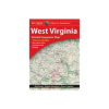
Delorme WEST VIRGINIA ATLAS & GAZETTEER

Our editorial team reviews specifications, product data, and field-use information to keep pages accurate.

Large-format Paper

Atlas and gazetteer for West

Includes Topographic

Elevation contours, highways, roads, dirt

Gazetteer Lists

Points of interest, landmarks, parks,

Includes Hunting

Zones, canoe trips, and scenic

Useful Sightseeing,

Back-road exploration, outdoor recreation, and

$22.99
View on Fin Feather Fur Outfitters

You'll be taken to Fin Feather Fur Outfitters to complete your purchase.

Hunter's Outpost earns a commission from affiliate links at no extra cost to you.

SKU: 010-13226-WV-753759306687

Overview

This West Virginia atlas and gazetteer is built for planning time in the field, with detailed paper maps that show topographic contours, major highways and roads, dirt roads, trails, and land use data. It also includes a gazetteer section with points of interest and outdoor destinations such as campgrounds, fishing spots, boat launches, hunting zones, scenic drives, and other recreation sites, making it a practical reference for trip planning. For hunters and other outdoorsmen who want a broader view of the state before heading out, it offers a useful way to organize routes and identify places worth checking. The large-format layout is suited to map reading at home, in camp, or on the road.

Why Hunters Choose the Delorme

Includes West

Virginia recreation locations like campgrounds,

Large-format Paper

Maps provide broad coverage for

Topographic Detail

Includes elevation contours, roads, trails,

Gazetteer Section

Lists points of interest, landmarks,

Useful Sightseeing,

Outdoor recreation, and trip planning

Key Features

  • Large-format paper atlas and gazetteer for West Virginia.
  • Includes topographic maps with elevation contours, highways, roads, dirt roads, trails, and land use data.
  • Gazetteer lists points of interest, landmarks, parks, campgrounds, boat launches, and historic sites.
  • Includes hunting zones, canoe trips, and scenic drive recommendations where available.
  • Useful for sightseeing, back-road exploration, outdoor recreation, and trip planning.

Best Used For

  • West Virginia trip planners who want paper maps for back roads and recreation areas
  • Hunters needing a gazetteer for hunting zones, landmarks, and access planning
  • Anglers looking for campgrounds, fishing spots, and boat launch locations
  • Outdoor travelers exploring scenic drives, trails, and state park areas

Specifications

Boat LaunchesIncluded
CampgroundsIncluded
Canoe TripsIncluded
Dirt RoadsIncluded
Elevation ContoursIncluded
Fishing SpotsIncluded
FormatLarge-format paper maps
Gazetteer SectionIncluded
Golf CoursesIncluded
Historic SitesIncluded
Hunting ZonesIncluded
Land Use DataIncluded
LandmarksIncluded
Major Highways And RoadsIncluded
Map TypeTopographic maps
Points Of InterestIncluded
Recreation SitesIncluded
Scenic Drive RecommendationsIncluded
StateWest Virginia
State And National ParksIncluded
TrailsIncluded
Trip PlanningIncluded

Pros

  • Includes West Virginia recreation locations like campgrounds, fishing spots, and general outdoor sites.
  • Large-format paper maps provide broad coverage for planning trips and back-road travel.
  • Topographic detail includes elevation contours, roads, trails, and land use data.
  • Gazetteer section lists points of interest, landmarks, parks, campgrounds, and boat launches.
  • Useful for sightseeing, outdoor recreation, and trip planning across West Virginia.

Considerations & Trade-offs

  • State-specific coverage means the level of detail and the exact recreation information can vary by state, so it is worth checking the West Virginia entries before relying on it for a trip plan.
  • This is a large-format paper atlas, so it offers broad reference detail rather than the convenience of a compact pocket guide or digital navigation tool.
  • The gazetteer includes many outdoor-use categories, but the available information is not uniform across every type of point of interest or location.
  • It is best suited to planning and route reference; it does not replace real-time conditions, closures, or on-the-ground signage.

Suggested Comparisons

  • State road atlases
  • Topographic maps
  • Gazetteers
  • Outdoor recreation maps

Suggested Accessories

  • Map case
  • Compass
  • Notebook
  • Pencil

Frequently Asked Questions

What kind of information does the West Virginia Atlas & Gazetteer include for hunters and outdoor users?

It includes topographic maps with elevation contours, major highways and roads, dirt roads, trails, and land use data. The gazetteer section also lists outdoor points of interest such as state and national parks, campgrounds, boat launches, historic sites, hunting zones, canoe trips, and scenic drive recommendations, though available information varies by state.

Does this atlas show hunting zones in West Virginia?

Yes. The product description specifically lists hunting zones in the gazetteer section.

Is this atlas useful for planning trips beyond hunting?

Yes. The description says it is intended for sightseeing, exploring back roads, outdoor recreation, and trip planning, and it also includes places such as campgrounds, fishing spots, boat launches, and scenic drives.

What format is the product in?

It is described as a large-format paper map atlas.

Does the product description specify exact page count, scale, or map dimensions?

No. Those details are not provided in the source data.