Camping GearDelormeSold by Fin Feather Fur Outfitters

Delorme

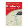
Delrome Atlas and Gazetter Kentucky

Our editorial team reviews specifications, product data, and field-use information to keep pages accurate.

Includes Back

Roads, dirt roads, and trails

Shows Elevation

Contours for terrain awareness

Marks Remote

Lakes, streams, and boat ramps

Identifies Public

Lands for recreation and land

Highlights Trailheads,

Campgrounds, and prime hunting and

$22.99
View on Fin Feather Fur Outfitters

You'll be taken to Fin Feather Fur Outfitters to complete your purchase.

Hunter's Outpost earns a commission from affiliate links at no extra cost to you.

SKU: 010-13226-KY-753759308346

Overview

This Kentucky atlas and gazetteer is built for hunters and outdoor travelers who need a practical view of the landscape beyond main highways. It brings together back roads, dirt roads, trails, elevation contours, and remote water features with public lands and recreation access points to help with trip planning and route selection. The coverage also includes land use and land cover such as forests, wetlands, and agriculture, along with trailheads, campgrounds, boat ramps, and other outdoor destinations. For anyone scouting unfamiliar ground or organizing a hunt, it offers a straightforward reference for navigating both access and terrain.

Why Hunters Choose the Delorme

Includes Back

Roads, dirt roads, and trails

Shows Elevation

Contours to help assess terrain

Marks Remote

Lakes, streams, and boat ramps

Identifies Public

Lands, trailheads, and campgrounds for

Covers Land

Use and land cover, including

Key Features

  • Includes back roads, dirt roads, and trails for route planning.
  • Shows elevation contours for terrain awareness.
  • Marks remote lakes, streams, and boat ramps.
  • Identifies public lands for recreation and land use types.
  • Highlights trailheads, campgrounds, and prime hunting and fishing spots.

Best Used For

  • Hunters planning access routes using back roads, dirt roads, trails, and public lands information
  • Anglers needing boat ramps, remote lakes, streams, and nearby recreation access points
  • Outdoorsmen scouting campgrounds, trailheads, and land-use details before a trip
  • Users mapping elevation contours and terrain features for remote Kentucky travel planning
  • Hunters and anglers looking for a Kentucky-specific atlas and gazetteer for field navigation

Specifications

Detail Commonly IncludesBack roads, dirt roads and trails, elevation contours, remote lakes and streams, boat ramps, public lands for recreation, land use, land cover forests, wetlands, agriculture, trailheads, campgrounds, prime hunting and fishing spots

Pros

  • Includes back roads, dirt roads, and trails for planning remote access routes.
  • Shows elevation contours to help assess terrain and route changes.
  • Marks remote lakes, streams, and boat ramps for water access planning.
  • Identifies public lands, trailheads, and campgrounds for recreation planning.
  • Covers land use and land cover, including forests, wetlands, and agriculture.
  • Highlights prime hunting and fishing spots for outdoor trip planning.

Considerations & Trade-offs

  • Coverage is focused on Kentucky, so it is most useful as a state-specific planning tool rather than a broader regional reference.
  • The atlas emphasizes commonly included map details such as roads, trails, contours, public lands, and recreation points, but it does not provide every possible on-the-ground detail for a specific area.
  • Information like prime hunting and fishing spots is presented as part of the map detail set, so it should be used as a planning aid rather than a substitute for current local conditions or regulations.

Suggested Comparisons

  • State atlas and gazetteer maps
  • Topographic maps
  • Public lands hunting maps
  • Fishing and boating maps

Suggested Accessories

  • Map case
  • Compass
  • GPS device
  • Waterproof document pouch

Frequently Asked Questions

What kind of information does the Delrome Atlas and Gazetter Kentucky include for planning a hunt or trip?

The product description says detail commonly includes back roads, dirt roads and trails, elevation contours, remote lakes and streams, boat ramps, public lands for recreation, land use, land cover forests, wetlands, agriculture, trailheads, campgrounds, and prime hunting and fishing spots.

Does this atlas and gazetteer include public land information?

Yes. The provided description specifically lists public lands for recreation among the commonly included details.

Can I use this for finding access routes and trailheads?

Yes. The description mentions back roads, dirt roads and trails, as well as trailheads, which suggests it is useful for route and access planning.

Does the product description say whether it shows hunting areas by species or season?

No. The source data only says it includes prime hunting and fishing spots; it does not provide species-specific or season-specific information.

Is this a map book for Kentucky specifically?

Yes. The product title identifies it as Delrome Atlas and Gazetter Kentucky.