Image unavailable
Our editorial team reviews specifications, product data, and field-use information to keep pages accurate.
You'll be taken to Sportsmans Guide to complete your purchase.
Hunter's Outpost earns a commission from affiliate links at no extra cost to you.
SKU: WX2*0748562
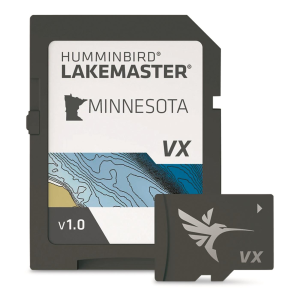
This Minnesota map card is built for anglers who want a more organized way to study lake structure and narrow their search on the water. It works with compatible Humminbird HELIX, SOLIX, APEX, and XPLORE units, and adds VX Technology with customizable color palettes for a tailored display. Features such as SmartStrike, Depth Highlight, Shallow Water Highlight, and Water Level Offset are designed to help you focus on selected areas and adjust for changing conditions. It also supports One-Boat Network integration with compatible Minn Kota trolling motors for contour-following navigation.
Minnesota Lakes
Map coverage in a compatible
Compatible Helix
HELIX G3/G3N and newer, SOLIX,
Vx Technology
Supports customizable color palettes and
Smartstrike Highlights
Likely biting areas on select
Depth Highlight
Helps target a selected depth
| Compatible Units | HELIX G3/G3N and newer, all SOLIX units, all APEX units, all XPLORE units |
|---|---|
| Customizable Color Palettes | Yes |
| Depth Highlight | Yes |
| Map Region | Minnesota |
| One Boat Network Compatibility | Yes |
| Product Type | SD card map |
| Shallow Water Highlight | Yes |
| Smart Strike | Yes |
| Vx Technology | Yes |
| Water Level Offset | Yes |
The product data says it is compatible with HELIX G3/G3N and newer, all SOLIX units, all APEX units, and all XPLORE units.
The source data identifies it as a Minnesota lakes maps SD card. No additional states or regions are listed.
The description says VX Technology provides exceptional map performance and customizable color palettes.
SmartStrike is described as a feature that highlights areas of the lake map where fish are most likely biting, and it is noted as being available on select HD Lakes Only Chart Presets.
The product data lists Depth Highlight, which lets you highlight a selected depth range, and Shallow Water Highlight, which uses red shading on an adjustable range from 0 to 60 ft. It also includes Water Level Offset to synchronize contours and shorelines with actual water levels.