Image unavailable
Our editorial team reviews specifications, product data, and field-use information to keep pages accurate.
You'll be taken to Fin Feather Fur Outfitters to complete your purchase.
Hunter's Outpost earns a commission from affiliate links at no extra cost to you.
SKU: 601002-1-082324056598
This LakeMaster chart set is built for anglers who want a more efficient way to read Great Lakes waters and narrow down productive areas. VX Technology supports customizable map display options, while SmartStrike helps highlight areas where fish are most likely biting. Select HD Lakes Only chart presets make it easier to switch between custom views, and the depth highlight and shallow water highlight tools help focus attention on specific water ranges. Water Level Offset adds another layer of chart adjustment by syncing contours and shorelines to actual water levels on lakes, reservoirs, and rivers.
Vx Technology
Customizable color palettes and strong
Smartstrike Highlights
Fish are most likely biting
Select Hd
Lakes Only chart presets simplify
Depth Highlight
Helps target a selected depth
Shallow Water
Highlight uses adjustable red shading
| Depth Highlight | Highlight a selected depth range so you can target productive water and stay where the fish are |
|---|---|
| Select Hd Lakes Only Chart Presets | Simple and easy to change between your own custom view settings |
| Shallow Water Highlight | Easy-to-see red shading highlights shallow water areas on an adjustable range from 0 to 60 feet |
| Smart Strike | Highlights areas of the lake map where fish are most likely biting |
| Vx Technology | Provides exceptional map performance and customizable color palettes |
| Water Level Offset | Synchronize the depth contours and shorelines of your LakeMaster charts with the actual water levels of lakes, reservoirs and rivers |
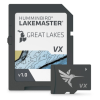
This is the Great Lakes V1 Select HD Lakes Only map product. The source data identifies it as a Select HD Lakes Only chart set for the Great Lakes region.
The listed features include SmartStrike, which highlights areas of the lake map where fish are most likely biting, plus Depth Highlight and Shallow Water Highlight for focusing on specific water ranges.
Yes. The source data lists VX Technology with customizable color palettes, and Chart Presets that let you switch between your own custom view settings.
Yes. Shallow Water Highlight uses red shading to mark shallow water on an adjustable range from 0 to 60 feet.
Yes. Water Level Offset is included to synchronize depth contours and shorelines with the actual water levels of lakes, reservoirs, and rivers.