Software > Computer Software > Gps Map Data & SoftwareHumminbirdSold by Humminbird Johnson Outdoors

Humminbird

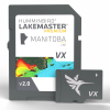
LakeMaster Premium Manitoba V2 Map

Our editorial team reviews specifications, product data, and field-use information to keep pages accurate.

Humminbird Lakemaster

Premium Manitoba v2.0 map card

Includes 2d

Shaded relief to help visualize

Aerial Imagery

For added map detail

Designed Help

Eliminate unproductive water and locate

Refer Chart

List under Resources for the

$199.99
View on Humminbird Johnson Outdoors

You'll be taken to Humminbird Johnson Outdoors to complete your purchase.

Hunter's Outpost earns a commission from affiliate links at no extra cost to you.

SKU: 1121513

Overview

Built for anglers who want a clearer picture of Manitoba waters before they launch, this mapping card adds 2D shaded relief and aerial imagery to supported Humminbird LakeMaster coverage. It is designed to help users study lakes and waterways with more context and spend less time sorting through unproductive water. For those planning trips across mapped bodies of water, it offers a practical way to organize scouting and refine where to focus. Coverage varies by card, so checking the chart list is important before purchase.

Why Hunters Choose the Humminbird

Includes 2d

Shaded relief for clearer lake

Adds Aerial

Imagery to help interpret shoreline

Covers Lakes

Waterways throughout Manitoba

Humminbird Lakemaster

Map users

Chart List

Available under Resources for coverage

Key Features

  • Humminbird LakeMaster Premium Manitoba v2.0 map card for lakes and waterways in Manitoba.
  • Includes 2D shaded relief to help visualize underwater structure.
  • Features aerial imagery for added map detail.
  • Designed to help eliminate unproductive water and locate fishing spots faster.
  • Refer to the Chart List under Resources for the full list of covered waters.

Best Used For

  • Anglers planning trips on Manitoba lakes and waterways covered by the chart card
  • Users who want 2D shaded relief and aerial imagery for map-based navigation
  • Humminbird owners looking for a premium LakeMaster map card for fishing trip planning
  • Serious anglers trying to identify productive water more efficiently before launching

Specifications

2d Shaded ReliefYes
Aerial ImageryYes
Bodies Of Water CoveredSee Chart List under the Resources tab
Chart List AvailabilityAvailable under the Resources tab
Map RegionManitoba
Map Versionv 2.0

Pros

  • Includes 2D shaded relief for clearer lake and waterway visualization.
  • Adds aerial imagery to help interpret shoreline and surrounding features.
  • Covers lakes and waterways throughout Manitoba.
  • Designed for Humminbird LakeMaster map users.
  • Chart list available under Resources for coverage verification.

Considerations & Trade-offs

  • Coverage is limited to the bodies of water included in the Manitoba V2 chart list, so it is worth confirming your target lakes and waterways before buying.
  • The card is designed for Humminbird LakeMaster use, so compatibility should be checked against your specific Humminbird unit.
  • The product emphasizes map detail, 2D shaded relief, and aerial imagery, but it does not provide physical gear features or on-water hardware benefits.
  • At $199.99, it is a specialized mapping purchase, so the value depends on how often you fish the covered Manitoba waters.

Suggested Comparisons

  • Fishing map cards
  • Sonar/GPS chart accessories
  • Regional lake maps
  • Aerial imagery map cards

Suggested Accessories

  • Chart card case
  • GPS fish finder mount
  • Screen protector
  • Memory card storage case

Frequently Asked Questions

What does the LakeMaster Premium Manitoba V2 Map include?

It is a Humminbird LakeMaster Premium Manitoba v 2.0 map card with 2D shaded relief and aerial imagery.

Which waters are covered by this map card?

The product data says a complete listing of covered lakes and waterways is available in the Chart List under the Resources tab.

Is this map intended for fishing use?

The description says LakeMaster Maps are designed to help eliminate unproductive water and find fishing spots faster.

Does the product description specify exact lake coverage or a full water list?

No. The provided data does not list the individual bodies of water; it directs you to the Chart List for that information.

What is the retail price?

The listed retail price is $199.99.