Software > Computer Software > Gps Map Data & SoftwareHumminbirdSold by Humminbird Johnson Outdoors

Humminbird

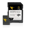
SmartStrike Midsouth States V4 (Legacy) Map

Our editorial team reviews specifications, product data, and field-use information to keep pages accurate.

Mid-south Edition,

Version 4 map card for

Adds Over

65 new lakes since the

Includes More

Than 270 High Definition lakes

Covers More

Than 385 total lakes across

Contour Data,

Depth highlight, and water level

$199.99
View on Humminbird Johnson Outdoors

You'll be taken to Humminbird Johnson Outdoors to complete your purchase.

Hunter's Outpost earns a commission from affiliate links at no extra cost to you.

SKU: 1103843

Overview

Built for anglers planning trips across Texas, Oklahoma, Arkansas, Louisiana, and Mississippi, this mapping card combines detailed lake coverage with SmartStrike search tools to help narrow down fishing locations by target species and conditions. It includes contour data, depth highlight, and water level offset features, along with more than 270 High Definition lakes and over 385 total lakes in the region. The expanded Version 4 coverage adds over 65 new lakes since the prior release, giving users a broader reference set for trip preparation and on-the-water decisions. For those who want a more efficient way to evaluate Mid-South waters, it offers a practical balance of map detail and search functionality.

Why Hunters Choose the Humminbird

Covers More

Than 385 total lakes across

Includes Over

270 High Definition lakes for

Adds More

Than 65 new lakes since

Contour Data,

Depth highlight, and water level

Searches Target

Species using conditions like light,

Key Features

  • Mid-South Edition, Version 4 map card for TX, OK, AR, LA, and MS.
  • Adds over 65 new lakes since the prior version.
  • Includes more than 270 High Definition lakes overall.
  • Covers more than 385 total lakes across the region.
  • Provides contour data, depth highlight, and water level offset features.
  • SmartStrike search helps target species using light, wind, water clarity, and time of year.

Best Used For

  • Anglers fishing Texas, Oklahoma, Arkansas, Louisiana, or Mississippi waters covered by this card
  • Users who want species-based search tools using light, wind, water clarity, and season
  • Fishermen seeking contour data, depth highlight, and water level offset features in one card
  • Boat anglers planning trips across a large Mid-South lake network with many mapped waters

Specifications

Chart List ReferenceAvailable under the Resources tab
Contour DataIncluded
Depth HighlightIncluded
High Definition LakesMore than 270
LegacyYes
New Lakes AddedOver 65
Search ConditionsLight, wind, water clarity, and time of year
States CoveredTX, OK, AR, LA, and MS
Target Species SearchIncluded
Total LakesMore than 385
Version4
Water Level OffsetIncluded

Pros

  • Covers more than 385 total lakes across Texas, Oklahoma, Arkansas, Louisiana, and Mississippi.
  • Includes over 270 High Definition lakes for detailed map coverage.
  • Adds more than 65 new lakes since the prior version.
  • Provides contour data, depth highlight, and water level offset features.
  • Searches for target species using conditions like light, wind, water clarity, and season.

Considerations & Trade-offs

  • Coverage is focused on TX, OK, AR, LA, and MS, so it is region-specific rather than a broad nationwide map solution.
  • The card is built around Humminbird/LakeMaster-style features, so its value depends on using compatible equipment and the SmartStrike workflow.
  • SmartStrike’s species search accounts for conditions like light, wind, water clarity, and time of year, but it still requires the angler to interpret and apply those results on the water.
  • This is a Legacy version, so buyers should verify it matches their current charting needs before purchasing.

Suggested Comparisons

  • Fishing mapping cards for other regions
  • Lake contour map cards
  • Fish-finding chart cards
  • Humminbird-compatible mapping accessories

Suggested Accessories

  • Map card case
  • Memory card reader
  • Fish finder mounting accessories
  • Navigation chart holder

Frequently Asked Questions

What waters are covered by the SmartStrike Mid-South States V4 map card?

The card covers more than 385 total lakes across TX, OK, AR, LA, and MS, with more than 270 of those in High Definition.

What’s new in Version 4?

According to the product data, Version 4 adds over 65 new lakes compared with the prior version, including 60+ in High Definition.

Does this card include contour and depth tools?

Yes. The description says it includes contour data, depth highlight, and water level offset features found on a LakeMaster card.

How does SmartStrike help choose a fishing spot?

SmartStrike can search for your target species while taking conditions into account, including light, wind, water clarity, and time of year.

Where can I find the full list of covered waters?

The product data says to use the Chart List located under the Resources tab for a complete listing of all bodies of water covered by this card.